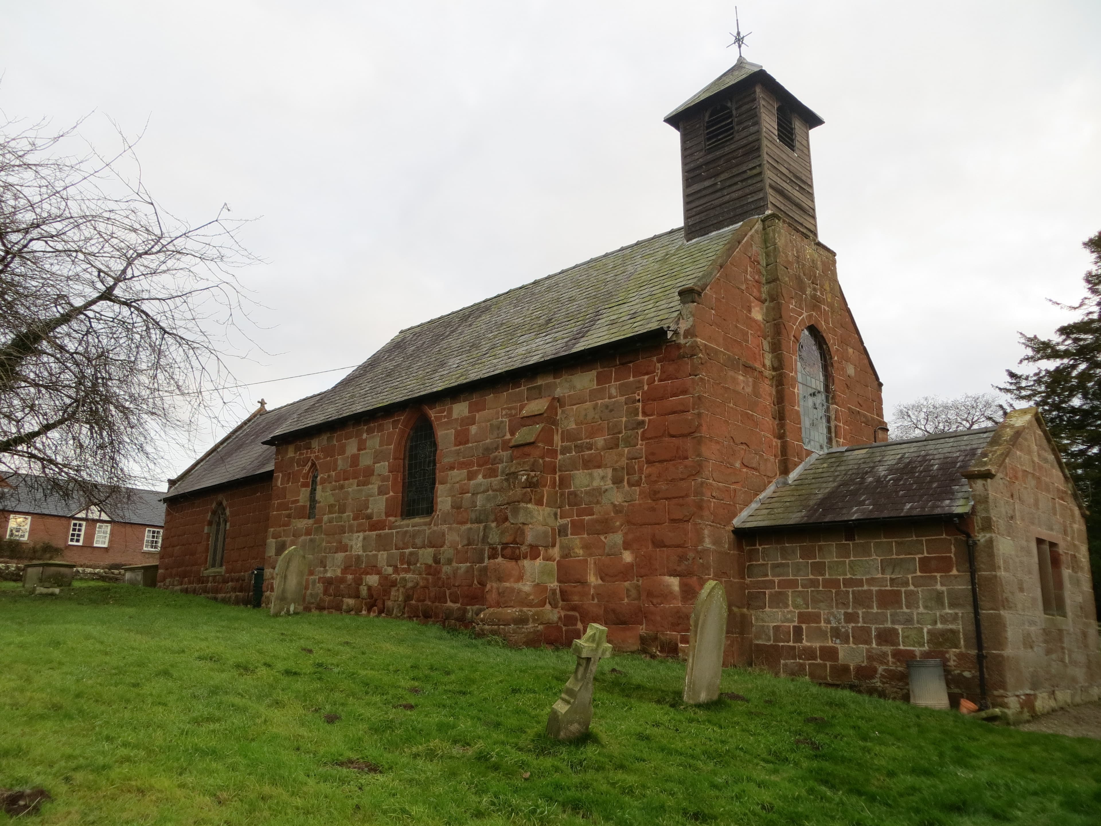
Shrawardine is a small village in Shropshire, west of Shrewsbury, near the River Severn. It is part of Montford civil parish. This guide introduces its setting, the available population figures and places to explore. Historic England ↗; Shropshire Council, p. 27 ↗.
Where is Shrawardine?
The village lies upstream from Shrewsbury on the north side of the River Severn. The remains of Shrawardine Castle stand on its eastern side. St Mary’s Church lies west of the castle. Jones, p. 15 ↗; Historic England ↗.
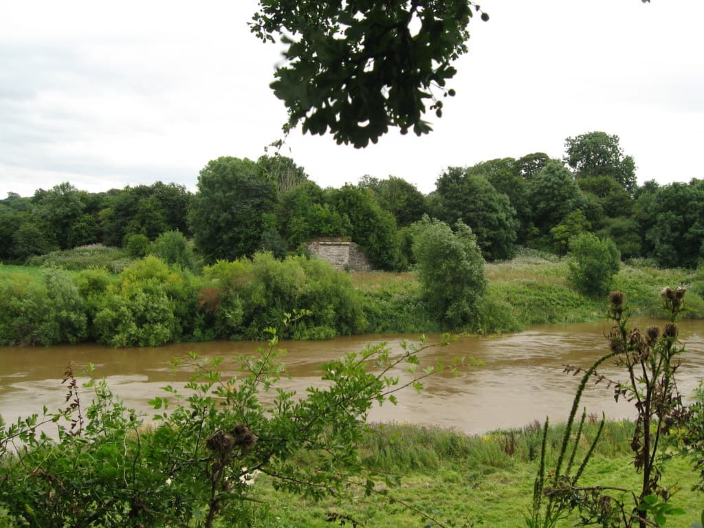 River Severn at Shrawardine, 17 August 2013. Photograph © Martin Richard Phelan, CC BY-SA 2.0.
Population and parish
Shropshire Council’s Draft Shropshire Community Hierarchy gives an estimated population of 102 and 50 dwellings for Shrawardine. Its method combines address data, the 2021 Census and small-area population estimates for 2024. These are figures for the community assessed in the planning document, rather than a count of everyone living here today. Shropshire Council, pp. 8 and 39 ↗.
The parish’s March 2023 church history describes a population of 140, but does not state the area covered or how the figure was calculated. The difference between the two sources has not been resolved; they should not be read as evidence of a fall in population. Parish history, p. 2 ↗.
For local council business, Montford Parish Council ↗ publishes meeting information and links to Shropshire Council services. Shrawardine.com is an independent guide; it is not the Parish Council.
The village today
St Mary’s Church remains a place of worship within the Severn Loop Parishes. Its parish history describes villagers joining the congregation at Christmas, Easter and other festivals, and volunteers caring for the churchyard. A Church Near You ↗; parish history ↗.
The church’s visitor information, checked on 18 September 2026, says it is normally open at weekends from the beginning of April to the end of September, with visits at other times arranged through the parish. Check the church’s current information ↗ before making a special journey.
Millennium Green connects the village’s community space with its historic surroundings. Jones’s archaeological account identifies the castle as the centrepiece of Montford Parish Millennium Green and records work organised by the Millennium Green Trust in 2001. The castle and settlement remains are a scheduled monument, while St Mary’s is Grade II* listed. Jones, p. 15 ↗; castle record ↗; church record ↗.
Explore Shrawardine
- Shrawardine Castle — the castle’s history, archaeology and surviving remains.
- Millennium Green — the Green, the Trust’s archaeological work and the documented footpath connection.
- St Mary’s Church — the building, its history and visiting information.
- River Severn — the former railway crossing and the surrounding area’s wartime history.
Sources & further reading
- Shropshire Council, Draft Shropshire Community Hierarchy, pp. 8, 27 and 39: population methodology, parish and community estimates. Accessed 18 September 2026. ↗
- Severn Loop Parishes, A Short History of St Marys Church, Shrawardine, version 1.0 (March 2023), p. 2. Accessed 18 September 2026. ↗
- N. W. Jones, Archaeological Surveys at Shrawardine Castle, with discussion by John Kenyon, Transactions of the Shropshire Archaeological and Historical Society, vol. 77 (2002), pp. 15–25. Accessed 18 September 2026. ↗
- Historic England, Shrawardine castle and settlement remains, NHLE 1015707. Accessed 18 September 2026. ↗
- Historic England, Church of Saint Mary, NHLE 1366943. Accessed 18 September 2026. ↗
- Church of England, St Mary’s, Shrawardine, A Church Near You: parish and visitor information. Checked 18 September 2026. ↗
- Montford Parish Council, official website: meetings and local information. Checked 18 September 2026. ↗
- Ordnance Survey, Shropshire sheet 033/NE, catalogued 1883–1895; Wikimedia Commons reproduction sourced from British History Online. Historical mapping for further reading. Accessed 18 September 2026. ↗
